Imaging Laser Scanner 3D + Drone Photogrammetry
Immediate interiors, exteriors and details "as-built" surveys
Our laser scanner technology tools capture everything around you with millimetric accuracy. Forget tape, roll and distance measures.
Our technicians human touch completes our software automation workflows, the result is a perfect technical-artistic survey.
We immediately identify walls and floors thickness, structural problems, hydraulic losses, volumetric increases and shrinkages, irregular surfaces.
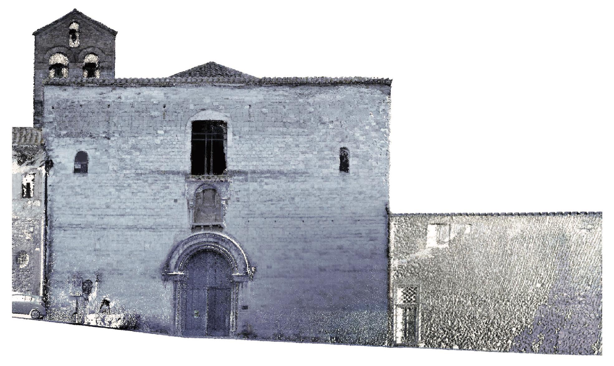
We process 360° scans (pointclouds) into CAD and BIM files.
Buildings, infrastructures or small details, there is no limit or impediment.
We measure anything, in any condition, without returning back in the field twice.
Get precise measurements in few minutes
We perform 360° scans at a very high precision, taking less than 1 minute per room
The acquired data are digitally archived, allowing an immediate use of the digital survey
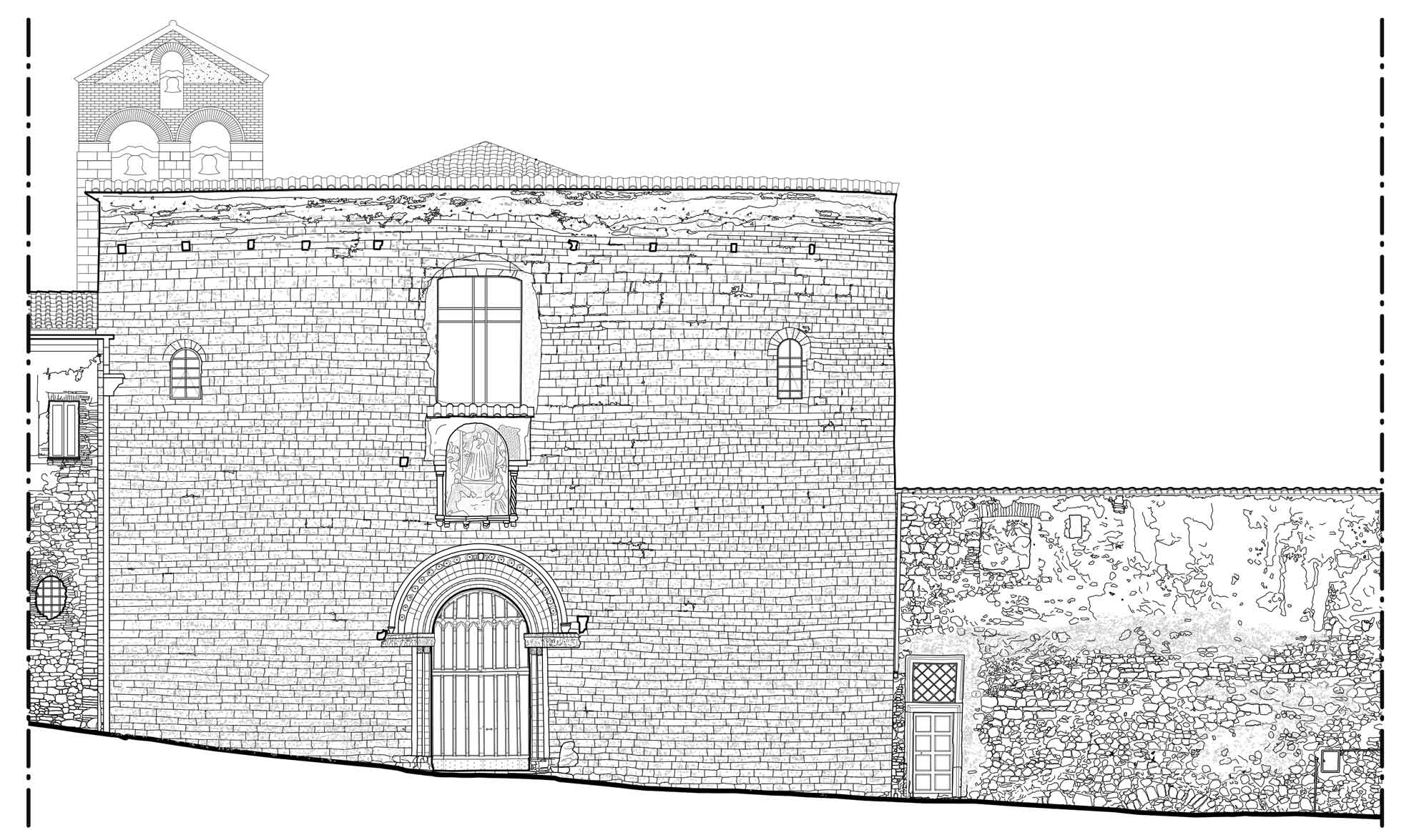
We extrapolate precise 2D, 3D and BIM drawings, delivering an accurate as built survey
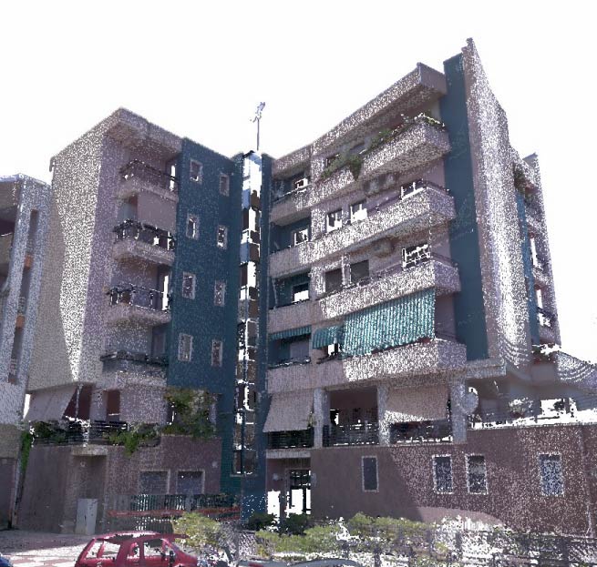
We capture digital surveys via Laser Scanner technology, we perform photogrammetric surveys with UAV drone.
We process your scans captured via Laser Scanner (pointcloud) in a 360° 3D navigable, interacting Survey.
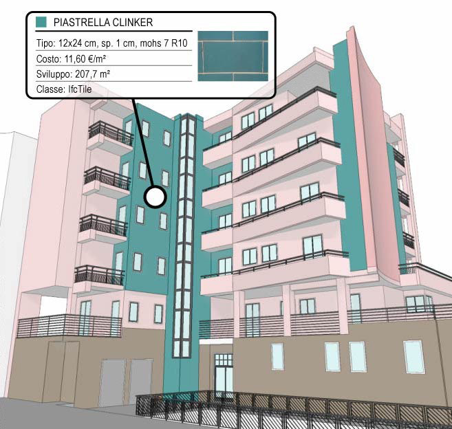
We elaborate your pointclouds from Laser Scanner Survey (pointcloud) in 2D CAD format, 3D mesh model with texture or BIM model.
Imaging Laser Scanner rental service with specialized operator to capture your 3D Surveys.
Aerial Drone rental solution with operator for aerial photogrammetry and 3D Relief return.

Copyright © LVI srls - VAT n.: IT04213270715